PLANNING FOR GROWTH NORTH
  • Home
  • COVID-19
  • Northern Municipal Services
    • Northern Municipal Services
    • Administration of the District (municipality) >
      • The District (municipality)
      • Public Notices in the District
      • Assessment Notice FAQ
      • District: Accounts Payable and Accounts Receivable
    • Northern Municipal Trust Account (NMTA) >
      • NMTA & Board
      • Northern Capital Grants Program
      • Northern Water and Sewer Program
      • Wildfire Mitigation Project
    • Northern Planning and Sustainability (NPS) >
      • NPS Unit
      • Planning for Growth North
  • Northern Communities & Areas
    • The Northern Saskatchewan Administration District (NSAD)
    • Towns >
      • La Ronge
      • Creighton
    • Northern Villages >
      • Air Ronge
      • Beauval
      • Buffalo Narrows
      • Cumberland House
      • Denare Beach
      • Green Lake
      • Ile-a-la Crosse
      • La Loche
      • Pelican Narrows
      • Pinehouse
      • Sandy Bay
    • Northern Hamlets >
      • Black Point
      • Cole Bay
      • Dore Lake
      • Jans Bay
      • Michel Village
      • Patuanak
      • St. George's Hill
      • Stony Rapids
      • Timber Bay
      • Turnor Lake
      • Weyakwin
    • District >
      • Settlements >
        • Bear Creek
        • Brabant
        • Camsell Portage
        • Descharme Lake
        • Garson Lake
        • Missinipe
        • Sled Lake
        • Southend
        • Stanley Mission
        • Uranium City
        • Wollaston Lake
      • Resort Subdivisions >
        • East Trout Lake
        • Jan Lake
        • Keeley Lake
        • Lac La Plonge
        • Little Amyot Lake
        • Little Bear Lake
        • Michel Point
        • Napatak
        • Ramsey Bay
        • Sturgeon Weir
        • Tower Beach
        • Tyrell Lake
        • Wadin Bay
        • Whelan Bay
      • Cluster Subdivisions >
        • Deschambault Lake Subdivision
        • Eagle Point Subdivision
        • English Bay Subdivision
        • Kinoosao Subdivision
        • Lamp Lake Subdivision
        • Lloyd Lake Subdivision
        • Nemeiben Lake Subdivision
        • Potato Lake Subdivision
        • Sturgeon Landing Subdivision
      • Development in the District
    • Lac La Ronge Planning Area >
      • Advisory Northern Planning Commission
      • Development in the Planning Area
      • Planning Bylaws & Maps
  • Toolkits & Resources
    • Legislation
    • Bylaw Guides
    • Emergency Preparedness and Community Safety
    • Governance and Administration
    • Assessment & Taxation
    • First Nations & Métis Engagement
    • Social Development and Healthy Communities
    • Land Use Planning
    • Maps & Databases
  • Contact Us
PUBLIC NOTICE: Closure of Missinipe Wharf

Northern Settlement of Missinipe

Annual Notice to Consumers - Drinking Water Quality and Compliance for the Northern Settlement of Missinipe


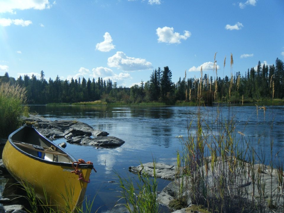
The Northern Settlement of Missinipe is located along highway 102 just above the northern edge of Lac La Ronge Provincial Park.  This beautiful community has many outfitters accommodating adventurers looking for some peace and tranquility of Northern Saskatchewan.

Missinipe Basemap
File Size: 243 kb
File Type: pdf
Download File

Missinipe
*All plans and bylaws available for download on this site may not include amendments and should not be used for legal purposes*

Current Projects
​


Please direct any questions or comments regarding the draft documents to Carissa Donaldson at Carissa.Donaldson@gov.sk.ca
Draft Official Community Plan (OCP) (2020): The Planning for Growth North program has created an OCP that members of the community can provide feedback on as the community works towards adoption. The Exhibits are an informative part of the OCP. The OCP also contains Future Land Use Maps, outlining the direction that the community intends to grow.
​Draft Zoning Bylaw (2020): The Planning for Growth North program has created a Zoning Bylaw that members of the Community can provide feedback on as the community works towards adoption. The Zoning Bylaw also contains a Zoning Map which divides the community into Zoning Districts, and a Use Table which shows which uses are allowed in each Zoning District.
Missinipe Official Community Plan DRAFT
File Size: 2147 kb
File Type: pdf
Download File

Missinipe Future Land Use Map DRAFT
File Size: 645 kb
File Type: pdf
Download File

Missinipe OCP Exhibits
File Size: 1073 kb
File Type: pdf
Download File

Missinipe Zoning Bylaw DRAFT
File Size: 574 kb
File Type: pdf
Download File

Missinipe Zoning Map DRAFT
File Size: 627 kb
File Type: pdf
Download File

Missinipe Use Table DRAFT
File Size: 54 kb
File Type: pdf
Download File


Planning Documents


Community Highlights (2012): The Saskatchewan Ministry of First Nations and Metis Relations, with help of the Ministry of the Economy conducted a snapshot in 2012 of the key components of the community, including: local government, demographics, economic environment, training and education, infrastructure, housing, emergency services, recreational opportunities, and the community's distance from larger centres.  
   
Community Highlights - 2012
File Size: 187 kb
File Type: pdf
Download File


Wildfire Risk Assessment (2005): The Saskatchewan Ministry of Environment actively attempts to educate residents about the threat of fire within municipalities.  They conducted an assessment of each municipality to determine the likelihood of wildfires, and implement FireSmart principles to help reduce the chances of wildfires starting.  
  
WRA - Missinipe
File Size: 6527 kb
File Type: pdf
Download File


Back to Top
  • Home
  • COVID-19
  • Northern Municipal Services
    • Northern Municipal Services
    • Administration of the District (municipality) >
      • The District (municipality)
      • Public Notices in the District
      • Assessment Notice FAQ
      • District: Accounts Payable and Accounts Receivable
    • Northern Municipal Trust Account (NMTA) >
      • NMTA & Board
      • Northern Capital Grants Program
      • Northern Water and Sewer Program
      • Wildfire Mitigation Project
    • Northern Planning and Sustainability (NPS) >
      • NPS Unit
      • Planning for Growth North
  • Northern Communities & Areas
    • The Northern Saskatchewan Administration District (NSAD)
    • Towns >
      • La Ronge
      • Creighton
    • Northern Villages >
      • Air Ronge
      • Beauval
      • Buffalo Narrows
      • Cumberland House
      • Denare Beach
      • Green Lake
      • Ile-a-la Crosse
      • La Loche
      • Pelican Narrows
      • Pinehouse
      • Sandy Bay
    • Northern Hamlets >
      • Black Point
      • Cole Bay
      • Dore Lake
      • Jans Bay
      • Michel Village
      • Patuanak
      • St. George's Hill
      • Stony Rapids
      • Timber Bay
      • Turnor Lake
      • Weyakwin
    • District >
      • Settlements >
        • Bear Creek
        • Brabant
        • Camsell Portage
        • Descharme Lake
        • Garson Lake
        • Missinipe
        • Sled Lake
        • Southend
        • Stanley Mission
        • Uranium City
        • Wollaston Lake
      • Resort Subdivisions >
        • East Trout Lake
        • Jan Lake
        • Keeley Lake
        • Lac La Plonge
        • Little Amyot Lake
        • Little Bear Lake
        • Michel Point
        • Napatak
        • Ramsey Bay
        • Sturgeon Weir
        • Tower Beach
        • Tyrell Lake
        • Wadin Bay
        • Whelan Bay
      • Cluster Subdivisions >
        • Deschambault Lake Subdivision
        • Eagle Point Subdivision
        • English Bay Subdivision
        • Kinoosao Subdivision
        • Lamp Lake Subdivision
        • Lloyd Lake Subdivision
        • Nemeiben Lake Subdivision
        • Potato Lake Subdivision
        • Sturgeon Landing Subdivision
      • Development in the District
    • Lac La Ronge Planning Area >
      • Advisory Northern Planning Commission
      • Development in the Planning Area
      • Planning Bylaws & Maps
  • Toolkits & Resources
    • Legislation
    • Bylaw Guides
    • Emergency Preparedness and Community Safety
    • Governance and Administration
    • Assessment & Taxation
    • First Nations & Métis Engagement
    • Social Development and Healthy Communities
    • Land Use Planning
    • Maps & Databases
  • Contact Us